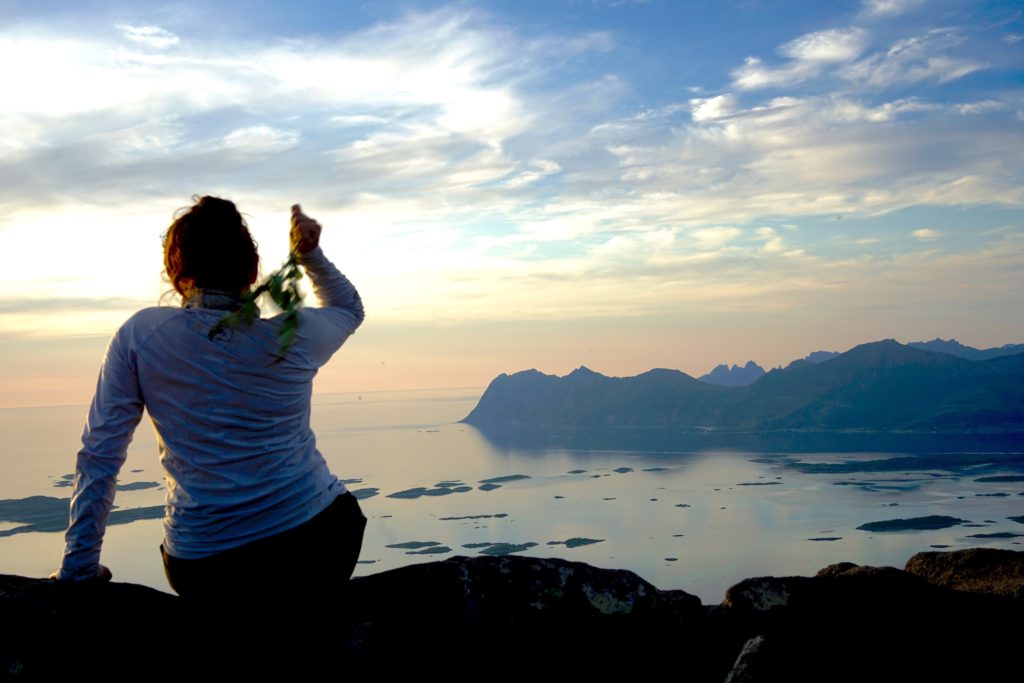
The best thing about visiting anywhere in Northern Norway during the summer is the midnight sun. Think of all the possibilities of things to do on the island when it’s light 24/7. I honestly struggle to find time to sleep because I keep getting distracted by all the endless adventures to be had.
The Midnight Sun: most people I talk to find it quite hard to imagine what the midnight sun is. Honestly if you’ve yet to experience it, it’s quite odd to think about! In places far north, you’re lucky to experience the phenamom known as the Midnight Sun… where quite literally, the sun is up at midnight because it doesn’t set! It’s still as bright at midnight (and later) as it is during the day. It can take quite a lot of adjusting and it’s really easy to lose track of time.
To the Mountains we go:
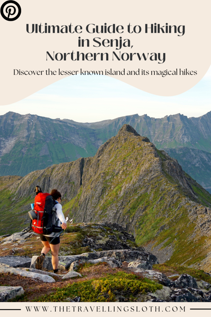
I’ve collected a list of hikes that I did when I travelled up to the Troms Region of Norway. Most of these hikes were around Senja but there are a couple I’ve added in that are outside but still within the Troms Region.
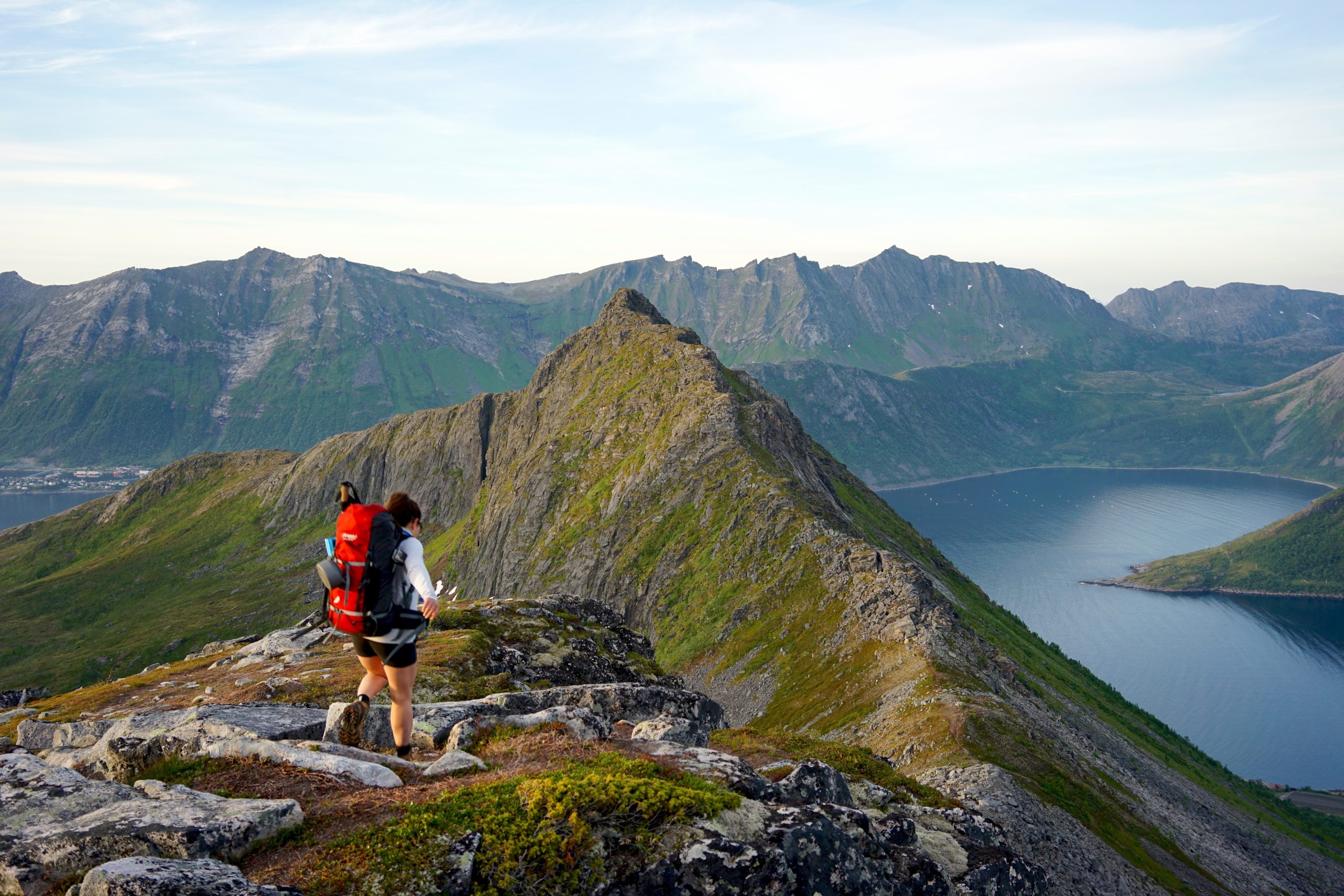
Hesten, Senja
Length: 5.8 km return
Elevation Gain: 581 m
Route Type: Out and Back
Difficulty: Hard
Approximate time taken: 2 hrs
Able to wild camp?: Yes, but it can be challenging to find a flat enough spot. You’ll have to come down on elevation.
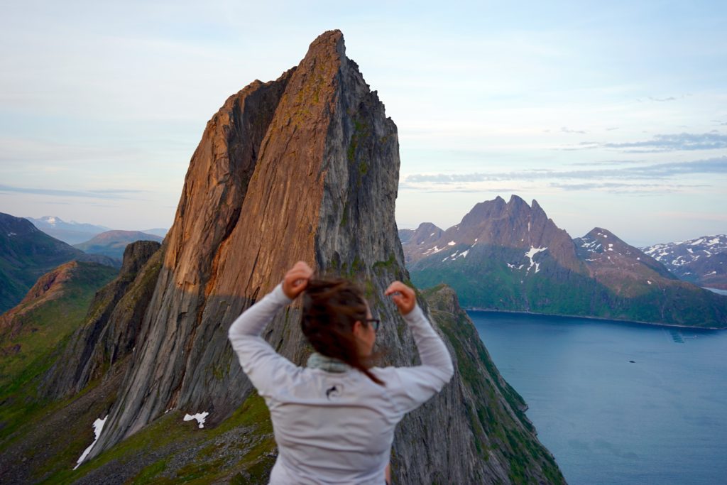
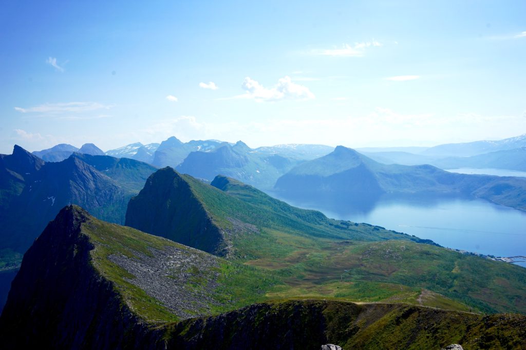
So the secret to seeing the iconic mountain of Senja (Segla) isn’t to hike it… but to hike to its neighbour, Hesten. I didn’t hike up Segla but the views from Hesten were killer. Imagined being sandwiched between Senja’s icon and the Instekongen Mountain Range. The hike itself starts in the green forest but takes you up a rocky landscape covered in shrubs and patches of greenery. For a short hike, it has quite a steep inclination, which makes this hike a challenge… Adding an overnight pack and vicious horseflies to the inclination does not help!
However, that didn’t deter me from camping overnight just below the summit of Hesten, overlooking Segla. While searching for a camp spot, there didn’t seem to be many flat, non-rocky areas to spend the night it is quite exposed.
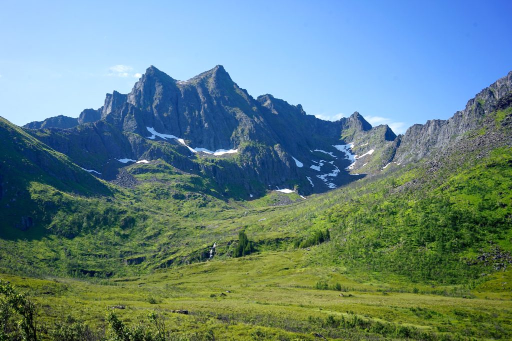
Barden, Senja
Length: 7.6 km return
Elevation Gain: 692 m
Route Type: Out and Back
Difficulty: Moderate
Approximate time taken: 3 hrs
Able to wild camp?: Yes! Plenty of spots either near the summit or just above the car park.
Hands down this is my favorite hike of all of Senja. I would probably go as far as to say, my favorite hike in Norway!!!
I parked just before the tunnel to Segla/Hesten and took the trail up from there. It’s a relatively simple hike. Closer to the parking, the trail can be quite muddy and bogged. But as you ascend up into the mountains, the views are absolutely breathtaking. On your left, you’ve got a view of Husøy and towards your right, the majestic Breitinden, Senja’s crown aka the tallest mountain on the island.
It was really difficult to focus on the path while being surrounded by the majestic mountain views. I may have taken one too many photos if that’s even possible… I regret not spending the night up on Barden. But that’s okay, got to save some for next time.
Husfjellet/Sommardalen, Senja
Length: 7.6 km return
Elevation Gain: 636 m
Route Type: Out and Back
Difficulty: Hard
Approximate time taken: 2.5hrs
Able to wild camp?: Some potential spots.
Between you and I, I wasn’t the biggest fan of this hike. It was probably due to the hiking conditions. It was hot (25 deg), a lot of horse flies trying to eat me and I may have broken my cardinal rule of hiking at midday, which I hadn’t done the entire trip. But I do know a lot of people who enjoy this hike! It offers the classic views over Senja and mountains as far as the eye can see. The lower part of the trail is through the forest but when you break through, it opens up to a beautiful view of the fjord down below.
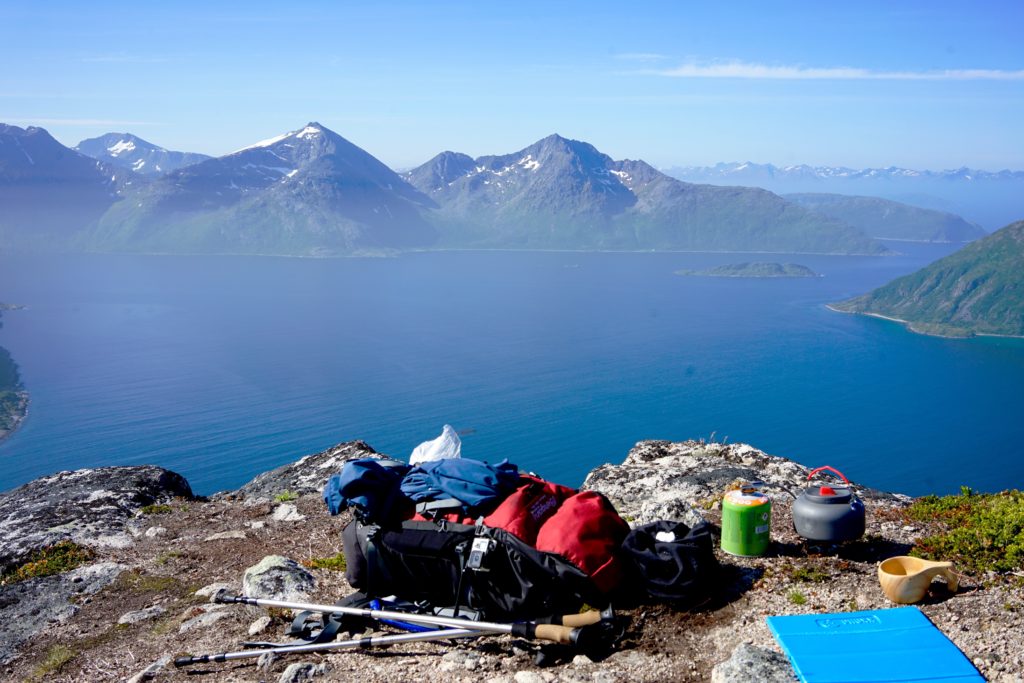
Sukkertoppen, Senja
Length: 5 km return
Elevation Gain: 337 m
Route Type: Out and Back
Difficulty: Moderate
Approximate time taken: 2hrs
Able to wild camp?: Nowhere near the summit. There’s a small flat area in the middle of the hike that you may potentially find enough space for.
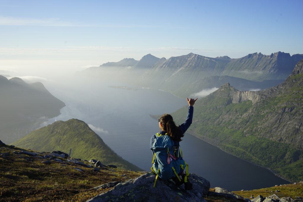
This was such a stunning place to watch the midnight sun as it skims the horizon in the distance. 360 views from the summit – one side opens up to the water and on the other side, you’re just surrounded by towering mountains. The majority of this hike was through the forest and was relatively flat until the mid-way point where it had most of the inclination as you make your way to the summit. Getting up to Sukkertoppen was no easy feat though! It felt borderline dodgy – at one point you have to use a chain to get up and a narrow footpath near the top. I would reconsider attempting the summit when it’s wet but that’s my personal opinion.
Local tip: You can park near Hamn i Senja, there’s a free layby area. I parked a little closer to the trailhead, off the road, and in a protected area. But also mind, I did start this hike at 2200hrs!
Skøyteneset, Senja
Length: 4.5 km return
Elevation Gain: 117 m
Route Type: Out and Back
Difficulty: Easy
Approximate time taken: 1.75 hrs
Able to wild camp?: Plenty of room along the trail!
I had been hiking every day on this trip and instead of relaxing on the beach, I stumbled upon this little trail! There’s barely any inclination – definitely is more spread out compared to most. While this is a really easy and relaxing walk, the views are absolutely banging. The mountain above is within view from the distance, you’re walking along the water and at the end, the sea opens up. If you sit still and quietly, you may observe some local wildlife. While sitting at the end of the trail, eating my muesli bar, I saw a weasel popping its head up wondering what I was!
Brosmetinden, Troms
Length: 3.9 km
Elevation Gain: 220 m
Route Type: Out and Back
Difficulty: Easy – Moderate (with an overnight pack)
Approximate time taken: 1 hr
Able to wild camp?: Yes, there are plenty of spots near the start of the hike. May be a bit difficult to find a flat spot near the summit.
Name a better place to have a morning cup of coffee… I will wait! While driving offroad in a little rental Swift felt a little daunting to get to the trailhead, but it was absolutely worth it! I started this hike close to midnight and it was an amazing introduction to the Troms region. It’s quite a short hike with a decent inclination so doing this hike after a winter hiatus and an overnight pack made this harder! The place I wild camped was a little flat patch of grass after the main summit of Brosmetiden, before the next summit. On the way back down the next morning, I set myself up at the summit and enjoyed a cup of morning brew.
Blåisvatnet, Lyngen Alps
Length: 11 km
Elevation Gain: 260 m
Route Type: Out and Back
Difficulty: Easy
Approximate time taken: 3.25 hrs
Able to wild camp?: No, the main trail is rocky. However, I did see people carry overnight packs so there’s probably a place to camp higher up in the mountains.
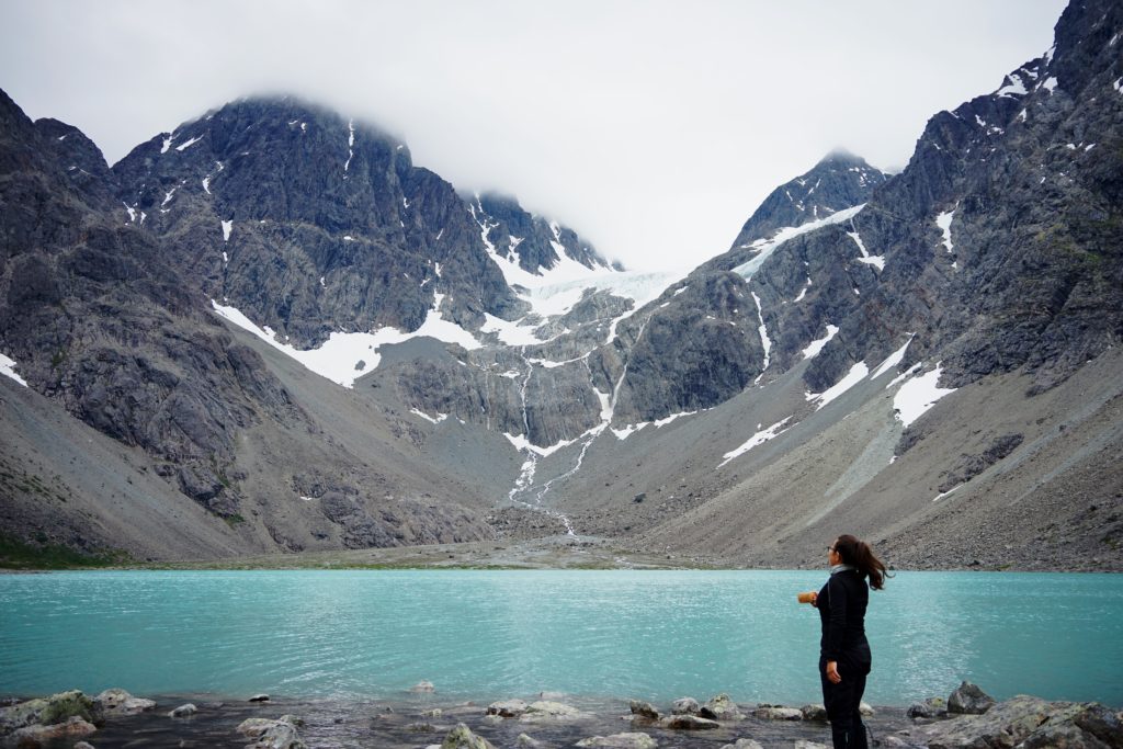
Imagine this: 12 deg overcast day, slight wind chill, brew with a view, river crossings, and swimming in a glacier lake.
Well, that’s exactly how this hike was! There was one deeper river crossing through the chilly glacier water that was approximately thigh deep on the way. But the majority of the hike was a steady uphill walk through rocky terrain. I would recommend sturdy mountain boots so you won’t accidentally roll your ankles. Swimming in that cold water isn’t for the fate of heart but you’ll see a few people jumping in and having a quick swim around. I know I did and it was REFRESHING! I spent the better part of an hour just enjoying the view and having my breakfast to this view.
Enjoyed this? Save it for later!
Well, there you have it! I spent just over a week exploring this region and I know I will be returning again to explore more. There are so many hikes worth doing that I’m sure you won’t get bored, I know at least 5 that I didn’t get to do on this trip… Northern Norway has a really special place in my heart and it’s not hard to see why! If you’re looking for somewhere to explore this summer and absolutely love being in the mountains, don’t look any further and just book the flights!

Leave a Reply